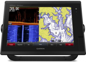
In terms of global positioning devices, Garmin has been a top the industry since their inception in 1989. The latest release is the Garmin 7612 Chartplotter . Designed for cruisers, sailors and sailing racers who demand quality marine products, ease of operation and cutting-edge features. Available now, this GPS chartplotter has tons of new features to have you feeling like a true adventurist.
Garmin 7612 chartplotter with 12-inch multi-touch widescreen display has a 10 Hz internal GPS that updates position and heading 10 times per second.
You can add your choice of Garmin marine radar, including our powerful xHD2 open array radars or xHD dome radars that pairs ease of use with advanced open array features.
It is fully network capable, including the Garmin Network and NMEA 2000.
The Garmin 7612 also pairs easily with dome or array radars. The 7612 comes preloaded with BluChart g2 maps as well as LakeVu HD maps.
Supports GSD™ premium sonar and GCV™ scanning sonar modules
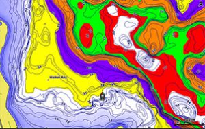
In addition to basic charts the Bluchart g2 features tidal stations, currents, depth contours, and more to provide the highest level of safety during your adventure.
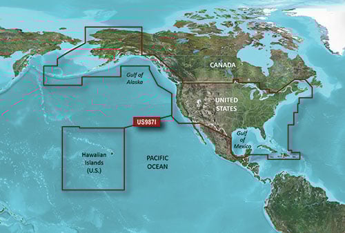
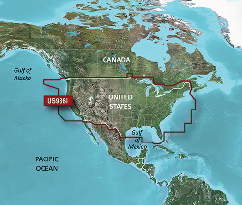
Preloaded BlueChart g2 Maps
In addition to basic charts, tidal stations, currents, depth contours, IALA symbols and included fishing charts, BlueChart g2 offers smooth transitioning between zoom levels and more seamless continuity across chart boundaries. You can customize your screens with Safety Shading that allows you to shade all depth contours shallower than your boat’s safe depth. Fishing charts emphasize bathymetric contours with less visual clutter on the display. And there’s also a choice of standard 2-D direct overhead or 3-D “over-the-bow” map views for easier chart reading and orientation.
Preloaded LakeVü HD Maps
These highly detailed freshwater maps include 17,000+ U.S. lakes, rivers and reservoirs. Included in those are more than 13,000 HD lakes with 1-foot contours shoreline to shoreline; excellent detail of underwater features plus Shallow Water Shading that allows you to designate a minimum depth; interstates, highways, general roads and bridges; designated fishing areas; and points of interest, such as docks, boat ramps, marinas and campgrounds.
The Garmin 7612 also comes equipped with sailing specific features, which included include laylines, enhanced wind rose, heading and course-over-ground lines, true wind data fields. –All aimed at making your time on the water safer and more efficient while still allowing you too have the fun you set out to have!
Staying connected with the Garmin 7612 Chartplotter has never been easier with built in WiFi and the
ActiveCaptain app which allows you to manage you marine experience from almost anywhere. Whether loading new maps or plotting a charter the 7612 allows you the chance to do it. One of the most important features is one that we hope you never have to use, the SOS safety assist feature makes it easier for anyone to call the Coast Guard in case of an emergency. Garmin as a whole continues to push the envelope in terms of technology and advancements in GPS integration, we look forward to what they bring us in the future.
To learn more about the Garmin 7612, click here.
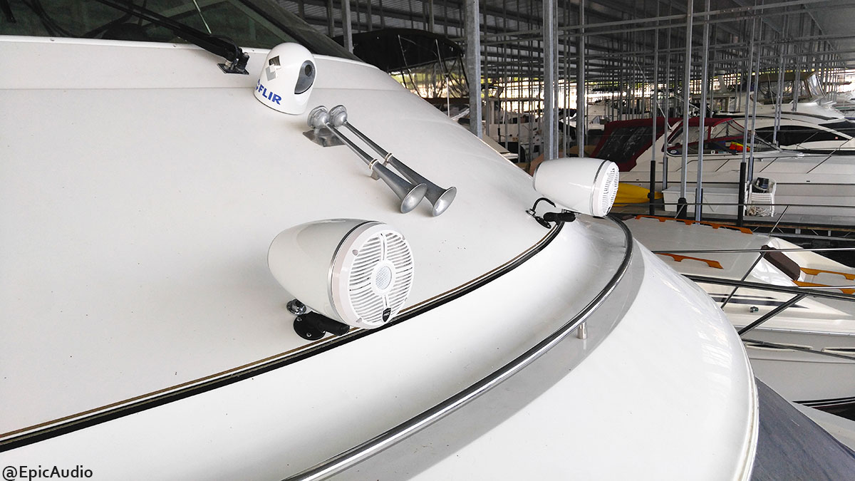
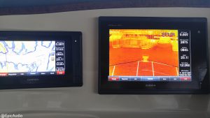
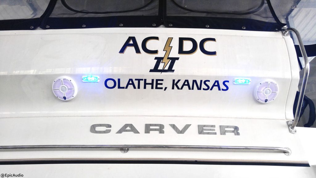
It has been a pleasure working on boats in Lake of the Ozarks because the outcome of joy that is endured by boaters while listening to your favorite tune as the sun sets to the west inside any boat. This boat that we(Epic Audio) worked on was a big success that included the custom installation of marine stereo equipment, navigation, night and heat vision and new radio.
What boat you may ask, it’s a 2005 Carver. A luxury boat that is now set up for pictures of the most epic sunsets.
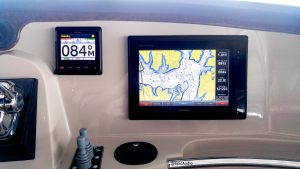
New Touchscreen’s from Garmin were installed first.
12-inch multi-touch widescreen display (1280 x 800 WXGA) preloaded with both BlueChart® g2 U.S. coastal and Garmin LakeVü™ HD maps
Built-in dual CHIRP sonar plus CHIRP ClearVü and CHIRP SideVü scanning sonar with the clearest images on the water (transducer sold separately)
High-sensitivity internal 10 Hz GPS/GLONASS
Fully network capable for Garmin Marine Network and NMEA 2000®, plus NMEA 0183 support
Supports GSD™ 26 professional sonar module
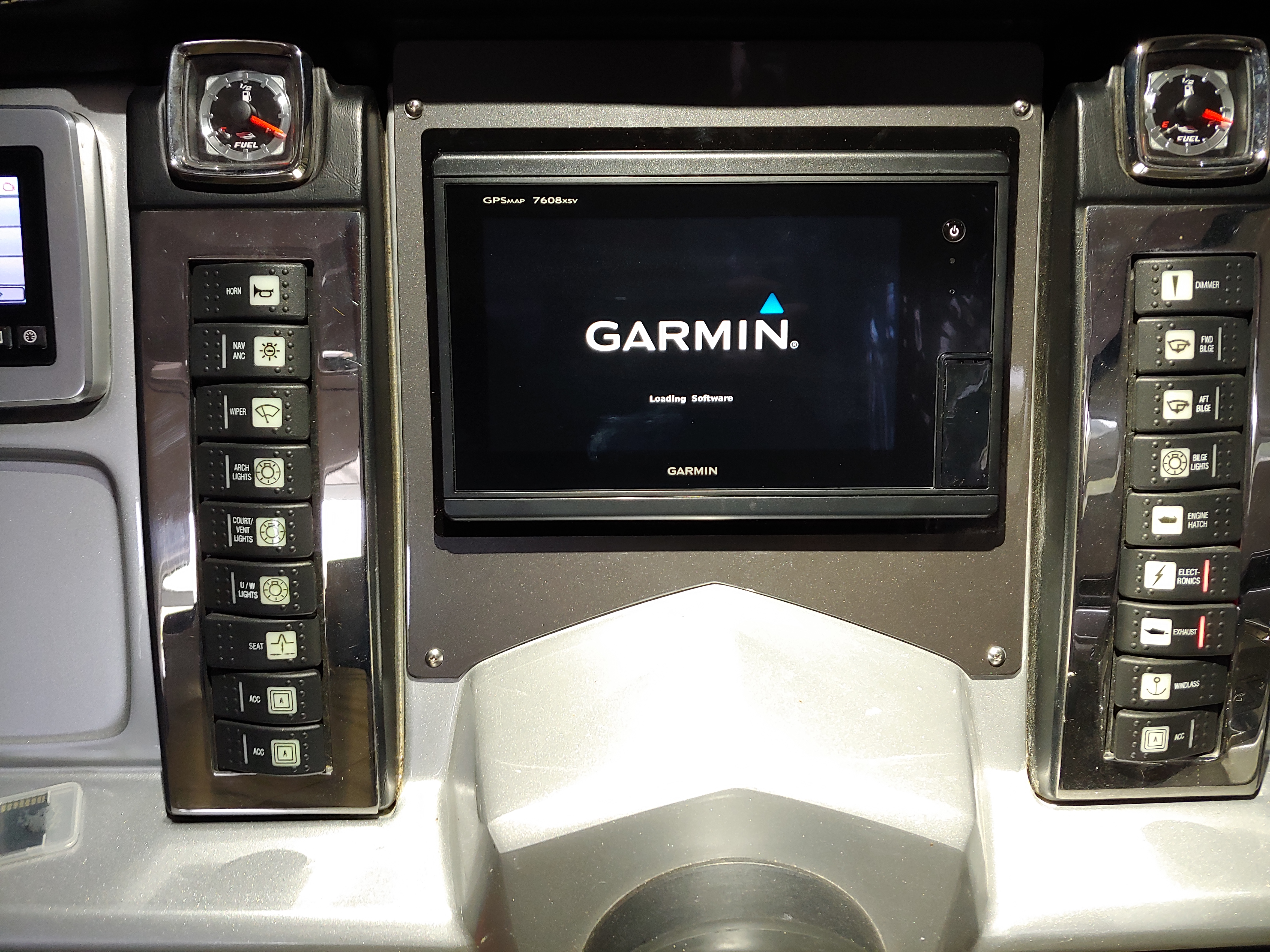
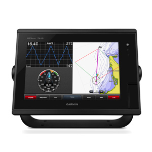
Designed for sportfishermen, cruisers, sailors and sailing racers who demand high performance, ease of operation and feature integration in a chartplotter/sonar combo. The 12-inch multi-touch widescreen GPSMAP 7612xsv combo includes built-in dual CHIRP sonar plus CHIRP ClearVü and CHIRP SideVü scanning sonar with the clearest images on the water. Its internal 10 Hz GPS updates your position and heading 10 times per second. GPSMAP 7612xsv is fully network capable, including Garmin Network and NMEA 2000, and offers the conveniences of built-in Wi-Fi® connectivity.
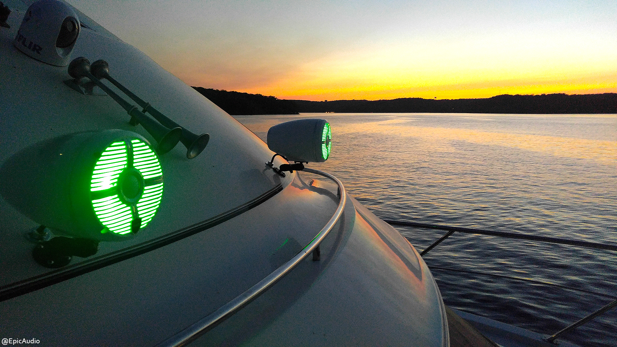
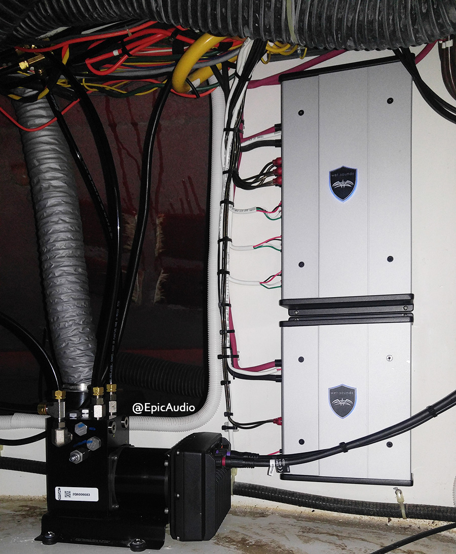
New Stereo Installed with Fusion Radio and WetSounds Amps and Speakers
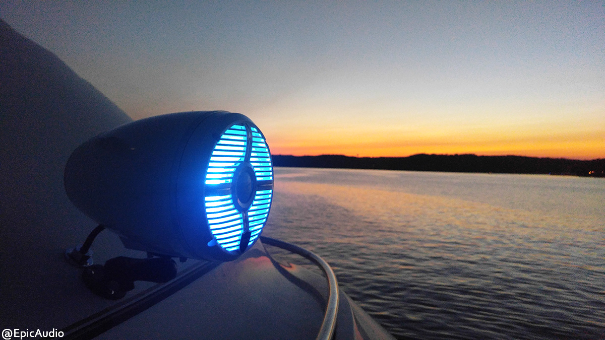
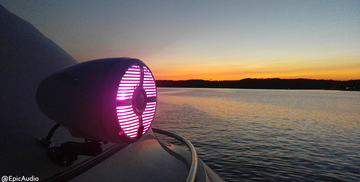
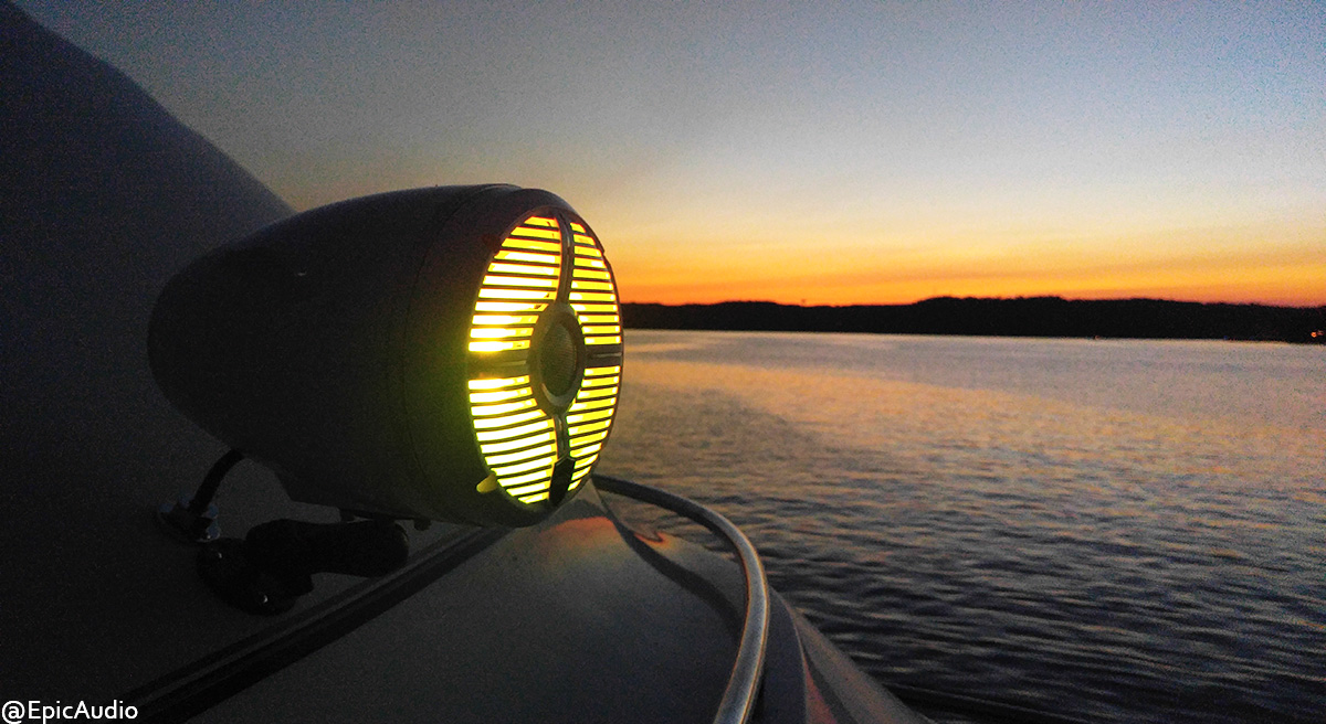
Both back and front of the Carver yacht, we installed WetSounds speakers that are RGB Color Changing with colors and pattern changes that are remote controlled.
To lead the speakers, the customer had chosen to use the Fusion Radio as the unit to be installed by the steering wheel.
Then a new Garmin VHF radio was installed to communicate with other vessels in the area of Lake of the Ozarks.
Garmin offers communications and Automatic Identification Systems (AIS) designed to enhance convenience and safety for mariners worldwide. All include Digital Selective Calling (DSC), a global protocol that uses channel 70 to transmit and receive digital messages. VHF radios equipped with DSC can send and receive digital emergency messages, private calls and general calls and let you call attention to VHF calls by using stored Maritime Mobile Service Identity (MMSI) numbers. DSC significantly improves the chances of rapid rescue.
Everything we do here at Epic Audio, has the highest standards of clean installation. Our wiring, identification and installations are thoroughly inspected and planned out to be and epic job well done.
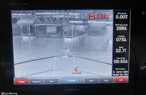
FLIR Maritime thermal imaging systems give you the power to see clearly in total darkness, through solar glare, and through light fog and smoke. FLIR’s thermal technology is used by thousands of military, first responder, commercial and recreational mariners every day for navigation, collision avoidance, threat detection, surveillance, and search and rescue missions.
Precise, easy-to-use, and reliable, explore your adventurous spirit with FLIR’s thermal night vision cameras. Whether fishing, cruising, sailing, or just exploring the ocean, remove limitations and enjoy a sense of personal freedom with the same advanced technology used by professional mariners and militaries around the world.
Having a beautiful day on the water with family and friends can be even more fun with electronic upgrades to your boat. Let Epic Audio handle your boat and equipment with care.
Have Epic Audio install your next electronic upgrade to your boat!
8-inch multi-touch widescreen display (1024 x 600 WSVGA) preloaded with both BlueChart® g2 U.S. coastal and Garmin LakeVü™ HD maps
Built-in dual CHIRP sonar plus CHIRP ClearVü and CHIRP SideVü scanning sonar with the clearest images on the water (transducer sold separately)
High-sensitivity internal 10 Hz GPS/GLONASS
Fully network capable for Garmin Marine Network and NMEA 2000®, plus NMEA 0183 support
Supports GSD™ 26 professional sonar module
Designed for sportfishermen, cruisers, sailors and sailing racers who demand high performance, ease of operation and feature integration in a chartplotter/sonar combo. The 8-inch multi-touch widescreen GPSMAP 7608xsv combo includes built-in dual CHIRP sonar plus CHIRP ClearVü and CHIRP SideVü scanning sonar with the clearest images on the water. Its internal 10 Hz GPS updates your position and heading 10 times per second. GPSMAP 7608xsv is fully network capable, including Garmin Network and NMEA 2000, and offers the conveniences of built-in Wi-Fi® connectivity.
Our installations are quality and we guarantee great craftsmanship. If you have any question or need assistance with what unit will be best for your budget and boat, please call us at 573-346-1909
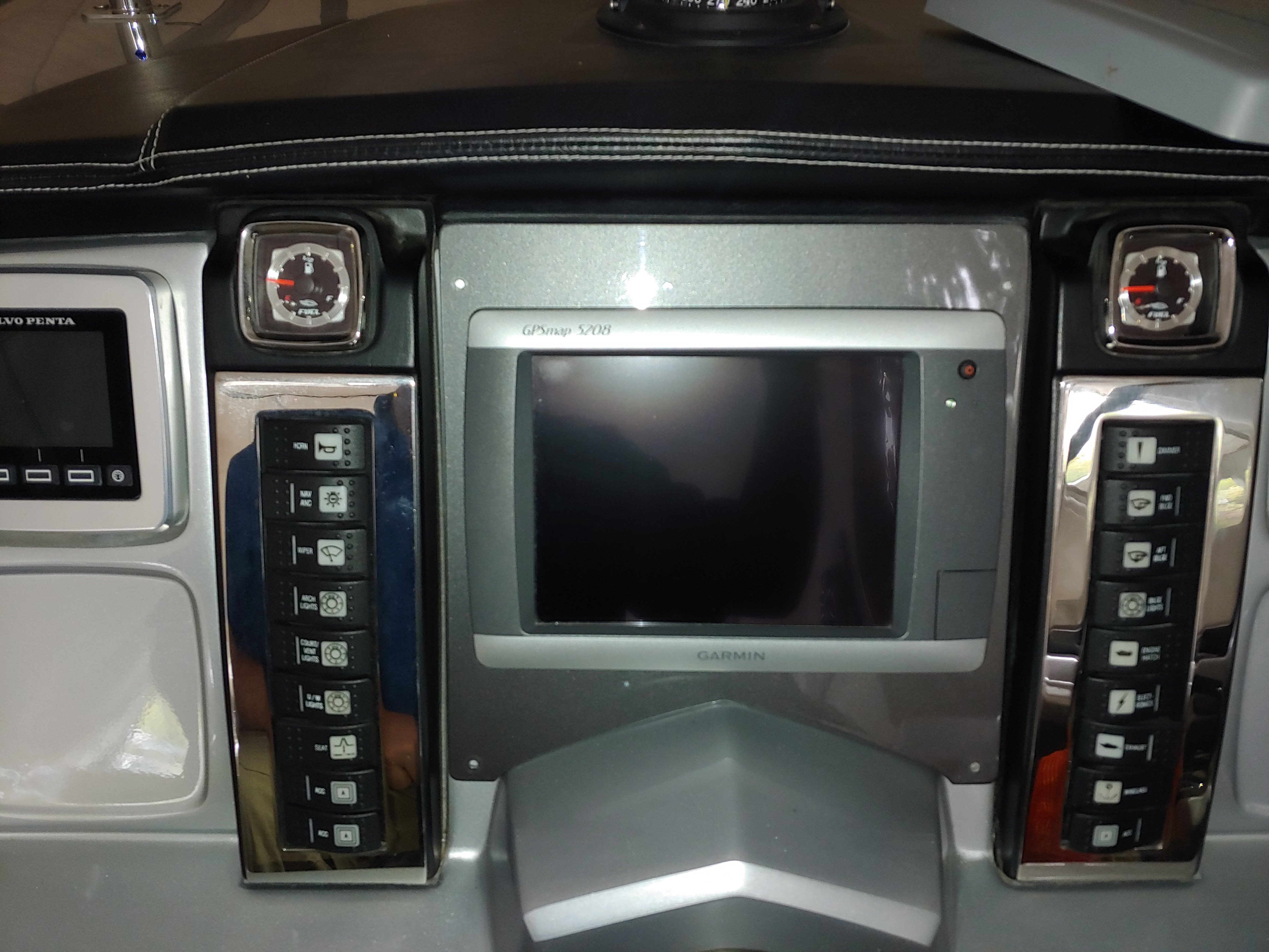
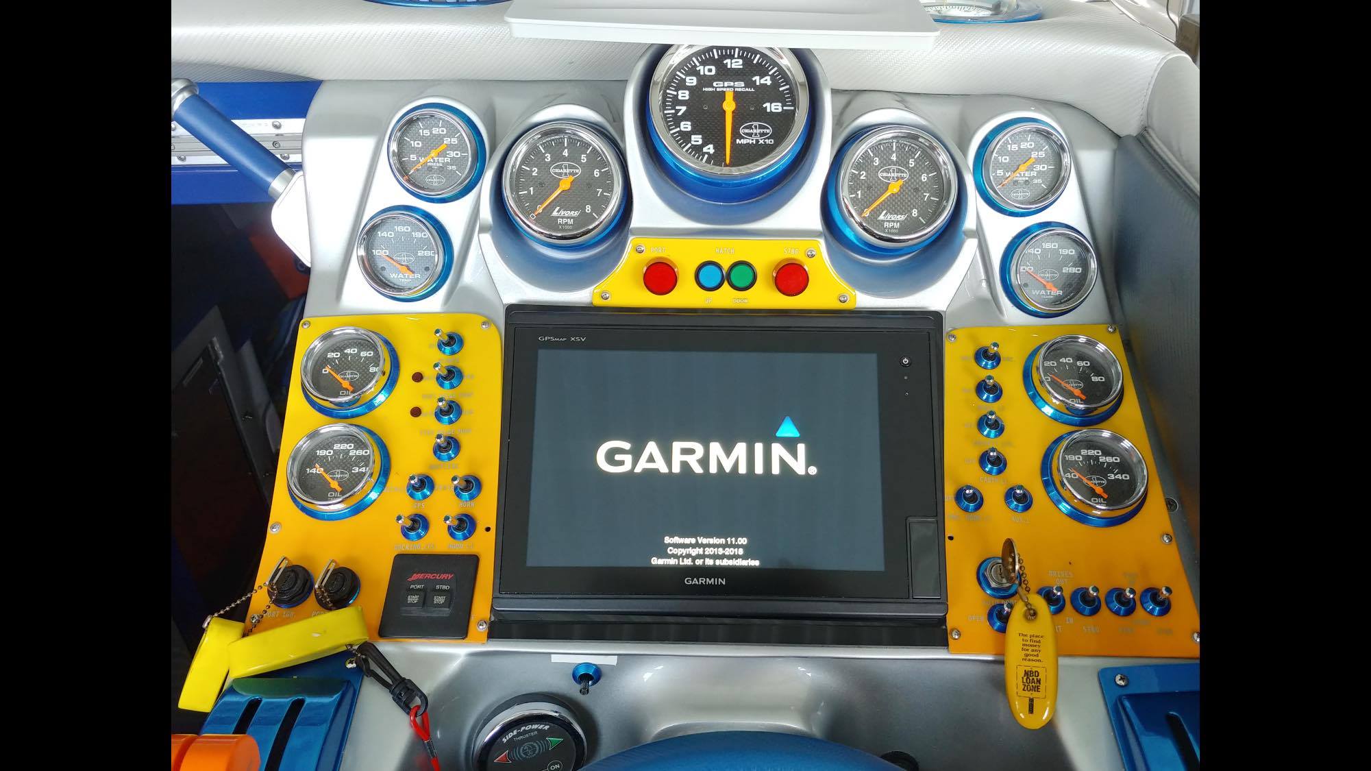
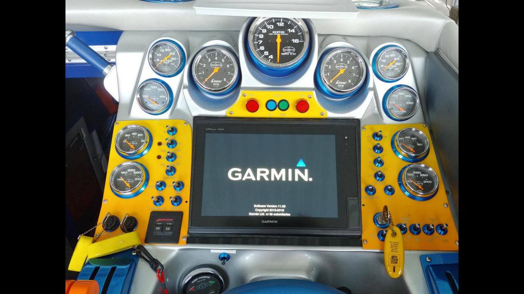
Owner of Epic Audio, Jason, installed a new Garmin GPSMAP 7610 which is a great 10 inch touchscreen in a local residents very powerful Cigarette Boat.
Before InstallationAfter Garmin is Installed
Getting a new boat with a touchscreen doesn’t mean that the electronics screen comes with good software or has the current update. This older technology that you may be buying with the boat, may cause more problems than you think. Make sure that you have the newest technology and the most current maps with a system that has the capability to connect with your other electronics.
This is were Garmin comes in with the best in safety and navigation.
With a system that offers so much, we will like to feature a couple in this post to help the residents of Lake of the Ozarks understand the value of a Garmin unit.
Simplified SOS Calling
This exclusive SOS safety assist feature makes it easier for anyone – even those not familiar with marine electronics or radio protocols – to quickly call for Coast Guard help in an emergency. By simply tapping the SOS button on the chartplotter’s touchscreen display, your networked Garmin VHF radio will automatically tune to the Channel 16 emergency frequency and a list of possible situations—fire, man overboard, etc.—will be displayed. Once the applicable choice has been selected, the screen will provide a Coast Guard approved VHF radio distress call script, along with the ship’s current lat/long GPS coordinates, that can be read off to responders – thus saving time, averting panic, and providing the essential information needed by rescuers to assure the best possible outcome.
Upgrade with the Best Maps on the Water
Two SD™ card slots provide expandable memory for accessory map purchases, such as LakeVü HD Ultra with Max Def Lakes or BlueChart g2 Vision that add Garmin patented Auto Guidance and other great features.
FUSION-Link Entertainment System
Enjoy the ability to control all compatible FUSION-Link-enabled audio systems directly from your compatible chartplotter display.
The Ultimate Connected Boating App
Built in Wi-Fi gives you access to the free all-in-one ActiveCaptain® app, so you can manage your marine experience from nearly anywhere. It creates a simple yet powerful connection between your compatible mobile device and your Garmin chartplotter, charts, maps and the boating community. Wherever you are, you’ll have unlimited access to your cartography, the ability to purchase new maps and charts and access to the Garmin Quickdraw™ Contours Community. Stay connected with smart notifications on your chartplotter screen. You can also plan a trip or prefish a lake, and ActiveCaptain will automatically sync with your chartplotter. Even get notifications for software updates, and decide when to download them on your device.
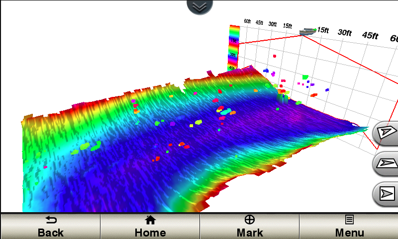
With 1 Panoptix Down transducer, you get 3 remarkable views, allowing you to actually see fish and bait swimming around under your boat – in real time. You can even see fish in the water column in 3-D, from the bottom to the surface. You can be stationary yet still see things in 3-D below your boat.
One Panoptix Forward transducer provides 2 impressive views, even while your boat is stationary. It shows the bottom plus fish and bait swimming in the water column in front of your boat – in real time. You can even see your lure as you reel it in. You can also get 3-D views of fish and structure in front of your boat.
Designate up to 10 different depth ranges each with its own color. Makes it easier to view target depths at a glance.
Commission Autopilot from Chartplotter
To make commissioning easier and more convenient, you can handle the entire autopilot commissioning process from your chartplotter screen.
Axis and FLIR Camera Support
Garmin offers support for select Axis cameras and for select FLIR cameras. These can be used for surveillance and situational awareness on vessels of any size. You can control your camera’s pinch-to-zoom and pan/tilt settings with gestures directly on the plotter screen and view video on multiple screens as well as multiple video streams on the same screen. Use an Axis encoder to convert analog camera, such as Garmin GC 10, to video over IP.
Make sure that you have the newest technology and the most current maps with a system that has the capability to connect with your other electronics.
Lake of the Ozarks is 92 miles long with 1,100 miles of shoreline. An up-to- date GPS system is a fundamental component in safe navigation on large lakes. From the most basic to the most fully-integrated systems, we’re happy to help guide you to the best set up for your boating needs.
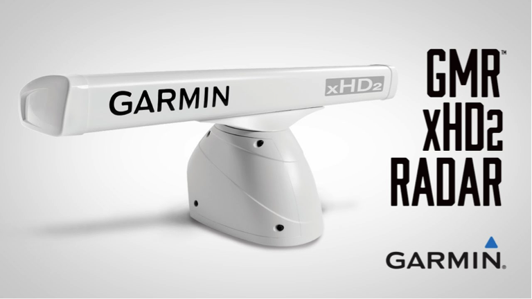
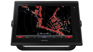
Boat’s Safety with Garmin Radar Products
The Garmin xHD2 radar antenna is one of the most trusted options for delivering high-resolution radar images to a variety of chartplotters. We install the xHD2 in many boats because it is the perfect base for a reliable GPS system, and we know because we use them ourselves.
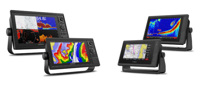
Garmin recently debuted the latest additions to their line of GPSMAP chartplotters and plotter/sonar combo units—the GPSMAP 742 and 942 touchscreen chartplotters, and the GPSMAP 1042xsv and 1242xsv keyed chartplotter. Available in a range of sizes from 7”-12” units, with built-in sonar options, the concept behind Garmin’s new units is to offer solutions to every boat owner, bringing premium features and the latest in chartplotting technology to budget-conscious customers.
The GPSMAP 742/942 series offers 7” and 9” sunlight-readable touchscreen chartplotters or combo units, with a 10Hz GPS/GLONASS receiver for smooth on-scree navigation. These units expanded on Garmin’s popular 7” touchscreen units that were introduced in 2010, offering larger screen sizes and the latest features. The 742 and 942 are equipped with wireless connectivity for the Garmin mobile APP, connectivity to the Garmin Marine Network for easy data transfer, and NMEA 2000 and NMEA 0183 connectivity for autopilot, VHF, digital switching and other sensors.
The GPSMAP 1042xsv/1242xsvseries offers 10” and 12” options with a sunlight-readable screen and keypad interface. The Keypad features a multi-function rotary knob that allows easy menu navigation even in rough water, as well as hotkeys that can be programmed for quick access to the user’s favorite features. The 1042xsv and 1242xsv offer the above mentioned features and capabilities of the 742 and 792, and are also equipped with built-in CHIRP sonar, CHIRP ClearVü and CHIRP SideVü.
Garmin’s new compact units offer a large range of solutions to boat owners and range from $799.99 to $1299.99.
Call us for more information and to schedule installation: (573) 346-1909

 Then a new
 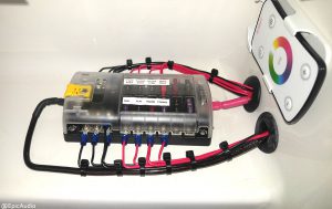 Everything we do here at Epic Audio, has the highest standards of clean installation. Our wiring, identification and installations are thoroughly inspected and planned out to be and epic job well done.